There are views that will live within me for a lifetime, somehow beyond what the eye can see, affecting my perspective on life as my shoulder and neck muscles tighten in surprise at first glance and then relax into the comfort of my own insignificance. Surrounded by, overcome by and somehow protected by something far greater than myself – far greater than my worries or inhibitions – there is a welcomed overwhelming peacefulness.
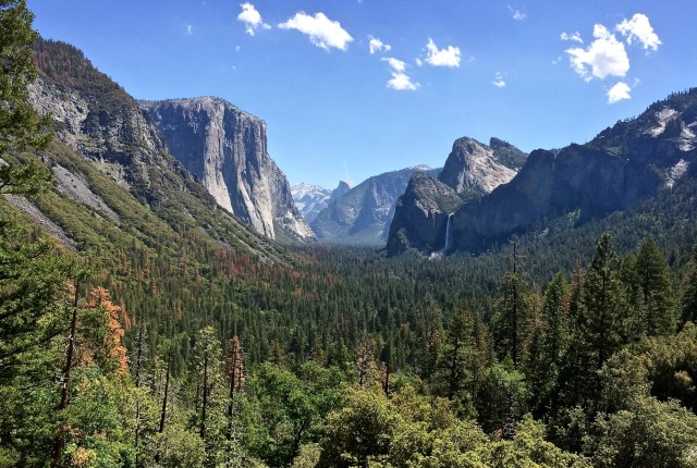
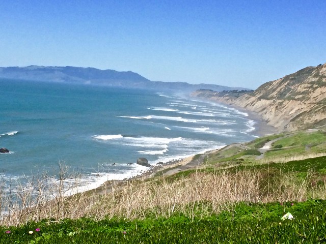
Yosemite Valley from “Tunnel View” — Joe’s re-take of Ansel Adam’s “Range of Light — “Bridal Veil Falls on the right — El Capitan on the left and Half Dome in the center in the distance. Taken 5/13/16 @ Noon
Long before I visited Yosemite as an adult, Ansel Adam’s photos of the park captivated me. In particular, I was drawn to a poster size print of his photograph of Yosemite Valley titled “The Range of Light.” It hung in my various houses for years – like a fantasy drawing of a beautiful place on a strange far away planet.
Now, years later, I find myself guiding tours to Yosemite from San Francisco at least once a week. The first stop on many of the tours is a place called “Tunnel View” (an overlook just before you enter a tunnel) and it is from this spot that Ansel Adams took his famous photograph, “The Range of Light.”
This is the same shot taken two weeks earlier, with some of the tourists included. Taken 4/29 @ 5:30 PM
As you can imagine, the Yosemite Valley portion of Yosemite National Park is one of the more popular places on earth. Over 4 million people, from around the world, visit here every year and most of them arrive in the summer. This is the classic “good news and bad news” story. The good news is that there are a lot of people that want to come to see Yosemite and I get to take many of them. The bad news is that it can often be crowded and traffic congested in a serenely beautiful place. I am not immune to “pull up the ladder” feelings i.e. “I have found this place and climbed up here, now lets just ‘pull up the ladder’ and keep the crowds away.” However, what helps me keep my perspective is the thought that maybe as high as 90% of the 4+ million visitors will also experience the view (and there are many) that will live within them for a lifetime. I live in anticipation of the moment when I am in Thailand, India, France, Australia, New York, Austin, Boise or where ever and someone asks … “Have you ever seen the view from the little pull over space just before you go into the tunnel at Yosemite?” Oh, what a conversation we will have!
If you follow this web page you will be hearing more about Yosemite and other places of interest in Northern California. Yosemite should be high on your list of places to see – it is worth putting up with the traffic. If you are in San Francisco I highly recommend that you take a Yosemite tour and leave the driving hassle to someone else. There are 1-day trips as well as 2 and 3-day trips available. If you are really pressed for time and have no other choice, then the one-day trip is for you. It is long and tiring but you can get it done in one day. I highly recommend the 2 day trip – which includes a hotel stay in the area and more time for sight-seeing, hiking, rafting, biking, relaxing in the park, etc. For the adventurous and fun loving there is a 3-day camping trip where we can supply the tent, equipment and guide.
There are a number of good Tour Guide companies in San Francisco. The one I work for is Incredible Adventures. They have great guides and are competitively priced. You can visit their web site and learn about the various trips (including Yosemite) and book on line. If you have any questions about tours in the Northern California area just leave me a message and I will get back to you. If you want to book a tour with me just let the Customer Service people know and let me know and I will try to make that happen.
For reasons that I am not too sure of, we travelers are always drawn to things that are “old” and/or “big.” This phenomenon could be called the “Castle/Cathedral Bias” and not only applies to buildings, but to all old or very big man-made structures whether that is the Taj Mahal, Panama Canal or Golden Gate Bridge.
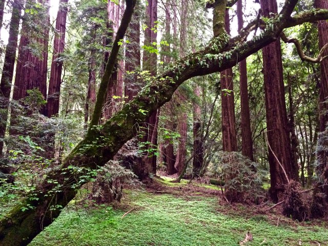
Muir Woods National Monument is home to one of the few groves of “Old Growth” Coastal Redwoods remaining. They stand in silent majesty having witnessed and thrived in their environment for over a thousand years.
In the world of trees, the biggest, tallest and oldest are 2 varieties of the Sequoia Redwood Tree. The Giant Sequoia trees of the Western Slope of the Sierra Nevada (Yosemite National Park, Sequoia Canyon and Kings Canyon) are the oldest living organisms on earth – ~3,200 years old. They are also the biggest (not tallest) trees in the world. With a diameter of 40 feet and a height over 310 feet they are jaw-dropping huge. I’m sure you have seen pictures of Giant Sequoias that were big enough for the center to be tunneled and a road laid down so a car could drive through the standing tree.
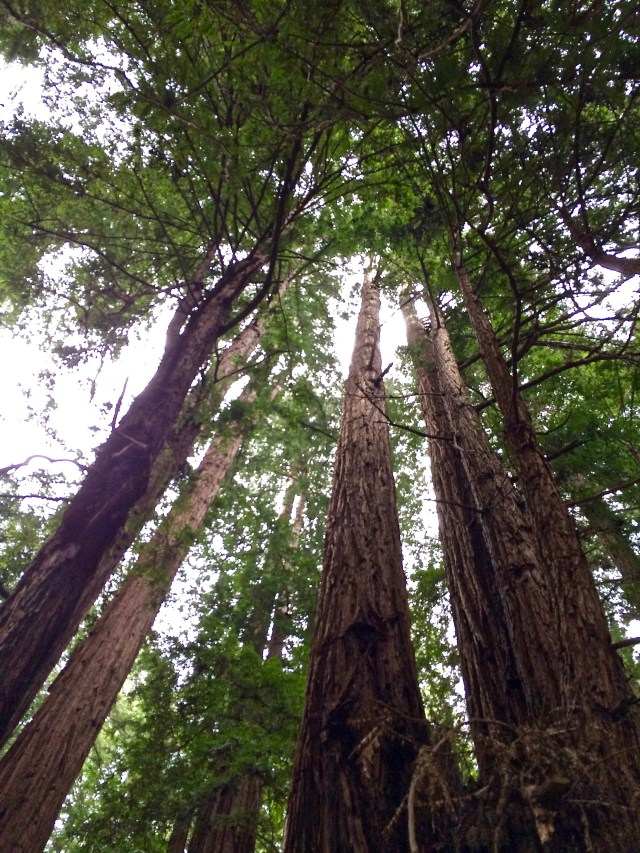
A closely related “cousin” to the Giant Sequoia is the Coastal Redwood (Sequoia sempervirens) that inhabits a thin and discontinuous 500-mile strip along the Pacific coast from southern Oregon to Big Sur California. The Costal Redwood is the tallest tree in the world at ~380 ft. (22 feet in Diameter). It was the Coastal Redwood (a.k.a. California Redwood, a.k.a. Coastal Sequoia) and it’s need for protection that motivated the creation of “Muir Woods National Monument.”
The Coastal Redwoods can reach a height of 380 feet. That is equivalent to about a 30 story building and tall enough to give you a sore neck trying to see the tops.
The major players that caused this National Monument to come into existence (William Kent, Teddy Roosevelt and John Muir) would, by there own and following generations, be considered “giants in the Naturalist movement”. And so, we have the giants of naturalists working to save the giants of the forest and in the process creating, in the words of John Muir, “… the best tree-lovers monument that could possibly be found in all of the forests of the world.”
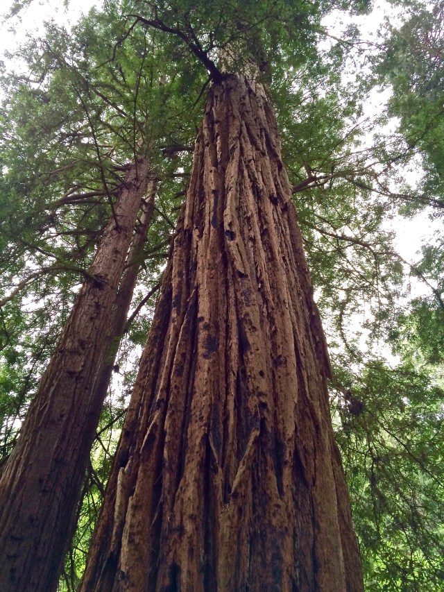
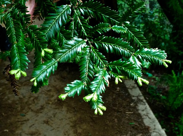
The bark on these trees is very dense, contains very little resin and is 12 inches thick. Thus the bark acts as a fire retardant barrier, protecting the tree during forest fires.
At the end of the Mexican/American War and the beginning of the soon to follow California Gold Rush, migration to the area grew rapidly, requiring wood to build for the exploding population.
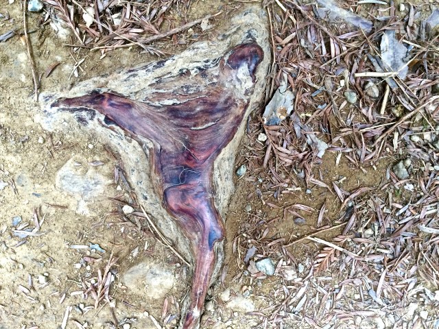
If the fire breaks thru the bark barrier it happens at the base of the tree and can hollow out a section creating a small room or burn all the way thru as with the tree on the right. The trees are unaffected by the fire. They bare the scars and continue to flourish. There has not been a significant fire in Redwood Canyon for over 150 years.
William Kent, perhaps the least known of our “Naturalist Giants,” was a successful and very well connected businessman who moved to the area as a child from Chicago. By the 1900’s William Kent and his wife Elizabeth, both lovers of the Northern California natural environment, foresaw the coming extinction of the magnificent Coastal Redwoods.
The Redwood Sorrel is one of my favorites at Muir Woods. They seem to particularly love the Redwoods as you often see them growing as close as they can to the base of the tree. They are a shade loving plant and display their heart shaped leaves in a clover configuration. When exposed to the sun they wilt into an umbrella shape.
In a secluded, difficult to access area running through Redwood Canyon, a well-established grove of “Old Growth” Coastal Redwoods remained untouched by the Lumberman’s ax and saw. These trees, located only a few miles from San Francisco, had never been logged due to the difficult accessibility of the canyon. There were other areas, farther away, that provided a more lumberman friendly harvest. In 1905 the Kent’s bought 611 acres centered along Redwood Creek with the intent of saving the Redwoods from the continuing California building boom.
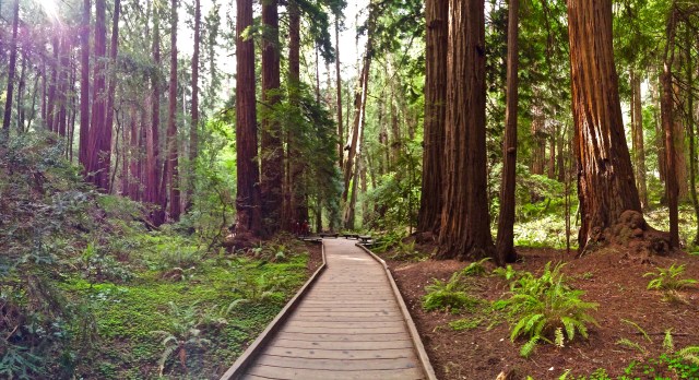
The Muir Woods Walking Tour meanders, next to Redwood Creek, through the stands of Costal Redwoods. The boardwalk, in addition to protecting the Redwood root systems from being trampled, offers an easy access surface for exploring the canyon floor and places to stop and just quietly “be” with the trees.
And then, as they say, “the plot thickens.” The following year, early in the morning of April 18th, 1906 the Great San Francisco Earthquake hit and, with the resulting fires, destroyed 80% of San Francisco taking over 3,000 lives and causing about 300,000 people (out of a population of 410,000) to lose their homes. The parks and beaches were jammed with tents and stayed that way for 2 years as San Francisco re-built. The need for wood to rebuild San Francisco posed a serious threat to the Coastal Redwoods of Redwood Canyon.
Most of the off-boardwalk trails are manicured to the point of making even the more remote areas accessible.
As if that wasn’t enough, in 1907 a private water company proposed to dam Redwood Creek, thus flooding the canyon in order to create a water supply for Sausalito, CA. They took William Kent to court in an effort to use “eminent domain” and take the land.
While walking one of the off-boardwalk trails I noticed an exposed Redwood root that had been polished over time by hundreds of boots. Beautiful Redwood burl bowls are available at the gift shop — bring money, they are not cheap.
William Kent, who later would serve as a member of congress for 3 terms and propose the legislation that would create the National Park Service, was very well connected in Washington DC. He wrote and sent photos to President Teddy Roosevelt proposing that he and his wife donate 295 acres of Old Growth Coastal Redwoods to the government. Roosevelt agreed and in early 1908 declared the land a National Monument, the first ever established from donated land.
A Costal Redwood over 1000 years old still showing new growth — suggests there is reason for hope.
Our third and most prominent naturalist is John Muir who was a noted political spokesman and ecological thinker whose enthusiasm and spiritual approach toward nature influenced many to re-think how we use our public lands. He lived less than 50 miles from Redwood Canyon on his father-in-law’s orchard that is now a National Historical Site in Martinez California. Known as “The Father of the National Park System,” he was the key influencer in petitioning the Congress to establish Yosemite National Park and, in the words of Robert Johnson (then editor of Century Magazine) “The voice crying in the wilderness” pleading that we honor our responsibility to cherish and protect the “wild.”
Muir Woods draws over 800,000 visitors per year. It is close to San Francisco, Sausalito, the Marin Headlands and on the way to Wine Country. I suggest you avoid the traffic hassle, include more than one destination and use a Tour Guide. There are a number of very good Tour Guide companies in the area. The one I guide for and recommend is Incredible Adventures (1-800-777-8464)
When Kent received word from President Roosevelt that the National Monument had been approved and suggested that the name should be Kent Monument, Kent demurred and requested that it be named after his friend John Muir. Thus Muir Woods National Monument is here for us today.
It is great to be healthy again after a little bout with pneumonia during my stay in Santa Fe. It has been a busy 2 months. By the time I recovered it was time to move on to San Francisco and take action on the decision to combine Travel Writing with Tour Guiding.
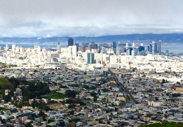
View of Downtown San Francisco from Twin Peaks Park as the fog layer lifts and the sun breaks through.
“So far so good,” as my father used to say. I was successful in applying for and gaining employment as a Tour Guide working out of San Francisco. The Tour Guide work will begin in early May and continue through October while the Travel Writing will be on going. The plan is that these activities will act synergistically. Tour Guiding will provide me a travel experience and perspective that is richer than what I experience traveling alone and my Travel Writing experiences will offer the tour participants the perspective from a full time traveler who may be in a position to present the current travel experience in unique light.
Golden Gate Bridge Bridge with San Francisco side clear and the Sausalito side in the fog. Photo taken from the western side of the Presidio.
That is the plan and we will see how it works. I am excited about this summer and all that there is to experience in this area. I feel like an eight year old that can’t wait for school to be over and the summer adventures to begin.
View From Mussel Rock Park which is in Daly City, a San Francisco Suburb.
The first of a series of pieces on my experiences in Northern California will appear here soon.
My task here is to relate to you my experience in tasting the products of Santa Fe Spirits, a unique “boutique” distillery located just outside of Santa Fe at 7000 feet above sea level and nestled at the foot of the Sangre de Christo Mountains. The distilled products of Santa Fe Spirit are designed to capture and accentuate the essence of the Southwest.
Colkegan Single-malt whiskey that uses Mesquite smoke vs. the traditional peat smoke of Scotland
I love the Southwestern United States with the long views that can incorporate mountains, deserts, forests of Ponderosa Pine as well as high plains that are capped by the biggest and bluest skies I have ever seen. I love the tastes and smells of this country. I love the way the light accentuates every crease in the terrain causing the details to “pop” with clarity. This is a photographers’ and landscape artists’ paradise.
As a lover of the Southwest and an experienced taster of distilled spirits I looked forward to tasting what Santa Fe Spirits had to offer. I enjoy drinking! I always have, I just can’t drink as often or as much as I used to without feeling like a truck ran over me the next day. I am reminded of a statement that my father once made: “I may not be as good as I once was but, I am as good once as I ever was.” Now, I am pretty sure that “Pop” wasn’t talking about drinking, but the point he was trying to make applies to my drinking habits. I certainly don’t drink as often as I did and, usually, I don’t drink near as much. However, when the occasion warrants and I am within crawling distance to my bed, I have been known to enjoy the company of close friends, turned “drinking buddies,” well into the night. In order for you to understand my perspective on taste testing distilled spirits, I will share a story.
Located in an industrial park just outside of Santa Fe sits a small unadorned building that houses the Santa Fe Spirits distillery.
Quite a few years ago, I was on vacation with close friends in Estes Park, Colorado. As three couples, we rented a large multi-bedroom condo and were enjoying trout fishing and exploring Rocky Mountain National Park. It was late in the afternoon of the 3rd or 4th day, just at the conclusion of a trout fishing adventure when the subject of the “best sipping whiskey” disturbed our mutual compatibility. I am a George Dickel fan and my two friends were adamant about Makers Mark and Jack Daniels. The combination of the discussion and the circumstances screamed at us: TASTE TEST! — TASTE TEST! It just so happened, that we found a liquor store on the way back to the condo and proceeded to buy a quart of each. Don’t ask me why, with just three of us participating, we needed a quart of each. It just “seemed like a good idea at the time.”
The Santa Fe Spirits Still incorporates the latest technology necessary to successfully operate within a very tightly controlled process.
So we sat and tasted and shared our opinions – then tasted some more. Our conversations could be described as wide-ranging, comfortable, well lubricated and laced with laughter. We told tall tales and laughed and joked and had deep philosophical discussions that seemed both poignant and insightful but I’ll be damned if I can remember what they were about. I do remember that I caught a trout that was about half the size of my lure and that was hilarious at the time. We were in awe of this tiny trout with “an attitude” as we acknowledged his aggressiveness by hoisting our glasses in a toast to the “Macho Minnow.”
We were conscientious about tasting one brand at a time – very carefully – then going to the next one and then to the last one, only to forget the subtleties of the first one and start over again. As time and tasting continued, laughter and tears offered us a release from the stoicism that we demanded of ourselves in daily life.
This modest building in Santa Fe houses the very popular “in-town tasting room” for Santa FE Spirits.
Yes, it was true that we were having a difficult time deciding which was the “Best Sipping Whisky.” The fact that we “Tasters” were “blasted” to the point that our taste buds were numb might have been part of the problem. However, looking back, I believe that what we discovered was that the distillers of Makers Mark, Jack Daniels and George Dickel are all at the “top of their game.” They each buy large quantities of the same highest quality materials and distill the product from processes that they have developed over hundreds of years. The resulting products are excellent – the best – beyond comparison. And that is my point. We were trying to find differences and then judge which “difference” was the best. Early on, in our tasting efforts, I could taste the differences between the three whiskeys. However I was having a terrible time figuring out which taste I liked best. My favorite kept changing and then changing back again. Our problem was that there was no significant difference that lasted beyond one round of tasting.
The In-town tasting room is intimate and very popular with locals as well as tourists
You cannot compare Santa Fe Spirits to any of the mass production distillers. They are literally not comparable. It is like trying to compare a football team with a pick-up truck. Their unique, products are designed to capture the essence of the Southwest in every taste.
Their Single Malt (Colkegan Whiskey) rather than using peat smoke for flavor – as they do in Scotland – uses Mesquite smoke for an award-winning Southwest flavor.
Their gin (Wheeler’s Gin), in addition to the traditional Juniper, incorporates sage and the flower of the Cholla cactus.
They make an Atapino Liquor that incorporates Pinon Nuts, Ponderosa Pine sap and Oak to anchor the flavor to the Southwest.
The apples for their Apple Brandy or all from New Mexico and I suspect that – just as wine is a little better when made from grapes that have been “stressed” by cool weather — the New Mexico apples provide ideal robustness for Santa Fe Spirits Apple Brandy.
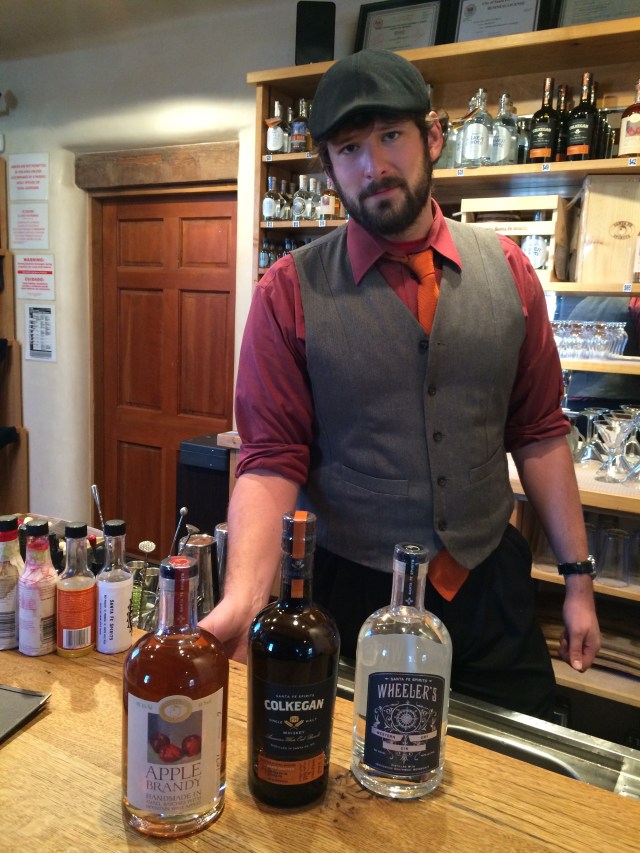
Sam, bartender and knowledgeable guide to customers of Santa Fe Spirits, guiding me through the distilling process to make: Apple Brandy, Colkegan Single Malt Whiskey and Wheelers Gin.
The taste test that matters is: When you taste the product do you like it and when you close your eyes does it bring you back to the Southwest. The answer for me is an emphatic YES. You might want to give it a try, especially if you have an affinity for, or a curiosity about, the Southwest.
You can get more information about these and other Santa Fe Spirit distilled products and buy them on-line at: www.santafespirits.com
As I travel from one area of this country to another I try to notice and articulate the differences so as to understand the uniqueness of place and to capture at least some of the things that make a place special. When you feel you have a “sense of a place” it is these differences coming to the surface of your unconscious that gives you that “feeling.” The uniqueness of a place lies in hundreds, if not thousands of subtle experiences that we are often barely conscious of and rarely able to articulate. How a place “feels” (everything from architecture, to natural environment, to the prevailing attitudes of the people) is tied to a unique and very complicated web of history, weather, geography, geology, indigenous plants and animals and often times the effects, over time, of interactions between multiple cultures.
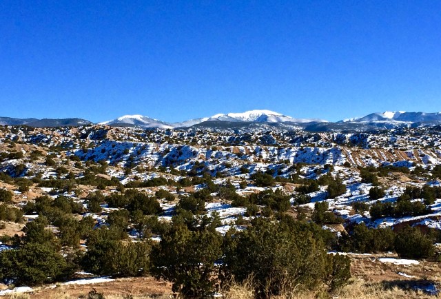
Taken not far from the little town of Chimayo north of Santa Fe. Big blue sky, dusting of snow and a low winter sun make a pretty picture
I am now spending a couple of months in the Santa Fe Area and in the early stages of “getting a feel” for the place. When I refer to the Santa Fe Area I am talking about the land that is rimmed on the North by Taos, NM – on the South by Albuquerque, NM – on the West by Los Alamos, NM. and on the East by Las Vegas, NM.
North Central New Mexico incl. Taos, Santa Fe, Los Alamos and Albuquerque
The land is not a desert though it is definitely arid. Immediately around Santa Fe you notice Pinon and Cedar trees mixed with Rabbit Bush, Sage, Yucca, Cholla and various wild grasses. The mountains seem to be in every direction — some up close, others on the horizon. The sky is big, sporting a deep pristine blue during the day and at night it appears as black velvet laced with beckoning diamonds. New Mexicans are proud of their clear skies and do their best to curb light pollution. It is DARK out here and I love it.
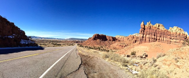
Mother Nature’s paint brush and sculpting chisel are in evidence as you drive north out of Santa Fe.
I am drawn to this area as I am to much of the Southwestern U.S., attracted to the openness of the country and largeness of the sky. From the majesty of the mountains to the beauty and serenity of the desert there is an “earthiness” about the environment that captures my attention and guides me to the joy of the present moment.
Historically, it was not an easy place to live off of the land. It was not like the East where an apparent abundance of water lavished the futile land that filled every valley lying between ancient, gentle mountains. It was not like the West where constant moderate weather and fertile soil produced the abundance that comes from a year round growing season.
Seasons came and were often harsh with the absence of moisture in the summer followed by blinding blizzards on the high plains and subzero temperatures in the mountains. It was a tough place to make a living and it evolved resilient, tough people who were forced to rely on themselves and members of their “extended family” (tribe). The Pueblo Indians understand desperation. With the empathy that comes through experience; fortified with Spiritual beliefs centered in the very land they occupy, they helped each other survive. In the process they bonded to each other creating a unique culture that has survived their conversion to Christianity.
Perdernal Mountain made famous by Georgia O’Keeffe paintings and source of flint for the Indians.
The Pueblo people have been living on the same ground since they migrated to this area from the Mesa Verde area around 1300. Unlike the neighboring nomadic Plains and Mountain Indians (Apache, Comanche, Navajo and Ute) the Pueblo stayed put and, in my opinion, represent the “core” of the ever-evolving cultures that now flourish in this place.
By the Late 1500’s the Spanish showed up with Spanish settlers and a considerable amount of livestock. They eventually established the Santa Fe settlement in 1610 just 3 years after the English settled in Jamestown. The Spanish controlled the area for over 200 years converting the Pueblo people to Christianity but never making a lasting peace with the Navajo, Apache, Comanche or Utes.
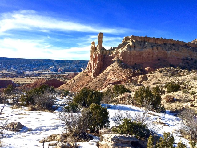
Chimney Rock formation at The Ghost Ranch 90 min. north of Santa Fe.
In 1821 Mexico won its independence from Spain. Once Spain was out of the picture the Mexicans allowed the opening of the Santa Fe Trail from Missouri to Santa Fe, Mexico in an effort to promote trade with the U.S. A little over 25 years later (1847) President Polk sent General Kearny and the “Army of the West” to take what was then Northern Mexico into the United States. (“Manifest Destiny” in action)
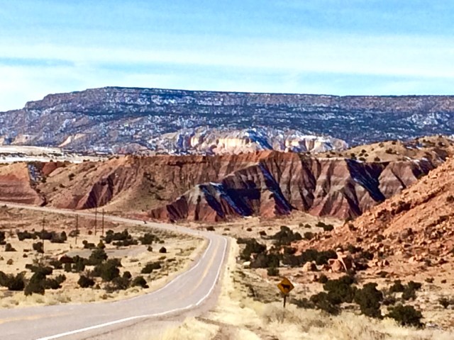
Sometimes the speed limit is just too fast. You have to stop and let the view have its way with you.
It is important to remember that this was not an area that was inhabited by English speakers that emigrated from the US and then wanted their new home to become part of the US. What is now New Mexico was conquered by the US (even if barely a shot was fired). We were foreigners that spoke a foreign language and the culture (way of being) that we brought was different and at times, at odds with the Native American, Spanish and Mexican cultures that were in place.
This area is “different” and it is with reason that Santa Fe is known as “The City Different.” More about that in future posts.
Traveling has become my life-style of choice. That fact, coupled with my general interest in history and science, means I frequent a lot of museums. It has been my experience that there is something to learn or, at minimum, a new experience to be found in all of them. However, there are a few – very few – museums that go far beyond “good” to the rarified realm of “GREAT.” So how do you know the difference between a “good” museum and a “GREAT” museum? At the end of your time in a “good” museum you appreciate what you have learned or, the new perspective on what you already knew. While, at the end of the “GREAT” museum visit you don’t want to leave. You find yourself thinking of reasons why you don’t have to go or trying to conjure ways to plan a return for more. A “GREAT” museum acts as a reference book for the subjects displayed at the museum. When I am hiking in or driving through a desert my experiences at the Arizona Sonora Desert Museum are my guide. My experiences there provide a frame of reference for understanding all of my desert experiences.
The sky is big and blue, the view is long, the Saguaros are standing guard. A perfect “Primetime” moment.
I first visited the Sonora Desert Museum over 30 years ago during a day off from a “Corporate America” National Sales Meeting held in the Tucson Area. Having been raised in the Midwest and lived in the Southeast and Northeast and Dallas Texas, I was unfamiliar with the desert or the plants and animals that not only survive but actually thrive in this harsh environment. It was at the Sonora Desert Museum where I was first introduced to and fell in love with the desert ecosystem.
Teddy Bear Cholla protecting Cactus Wren nest backed by Saguaro and Mesquite on the left and Palo Verde peaking in from the upper right.
The Sonora Desert Museum is not a museum in the classical sense. It is a unique composite of plant, animal and geologic collections with the goal of making the Sonora Desert accessible, understandable and treasured. The staff is succeeding in that goal. The museum was named as one of the top 10 museums in the country by Trip Advisor in 2014 and earlier this year the Desert Museum was inducted into the newly created Trip Advisor Hall of Fame for receiving their Certificate of Excellence for five consecutive years. This puts the museum in the top 1% of all attractions Trip Advisor rates worldwide.
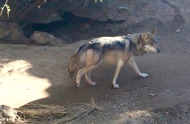
The Mexican Wolf was once found throughout the mountains of Southern Arizona into Mexico. They have been poisoned and trapped almost to extinction. There are now less than 50 of them alive in the wild.
At the end of my visit (Had an appointment in Phoenix an hour and a half away) I found myself planning my next visit as I was leaving the parking lot. If you are anywhere close to Tucson, AZ. take the time to visit this place. I am sure that you have heard people comment on the “beauty of the desert.” If you don’t understand that and want to know what you are missing, then a visit to The Arizona Sonora Desert Museum is a must.
Photo taken at Saguaro National Park
While you are there, you may want to take a side trip to the Saguaro National Park (West) just a mile or so down the road from the Desert Museum. They offer over 40 miles of great hiking trails in the Sonora Desert on 25,000 acres having over 2,000,000 Saguaro Cacti embellishing the desert floor and hills alike.
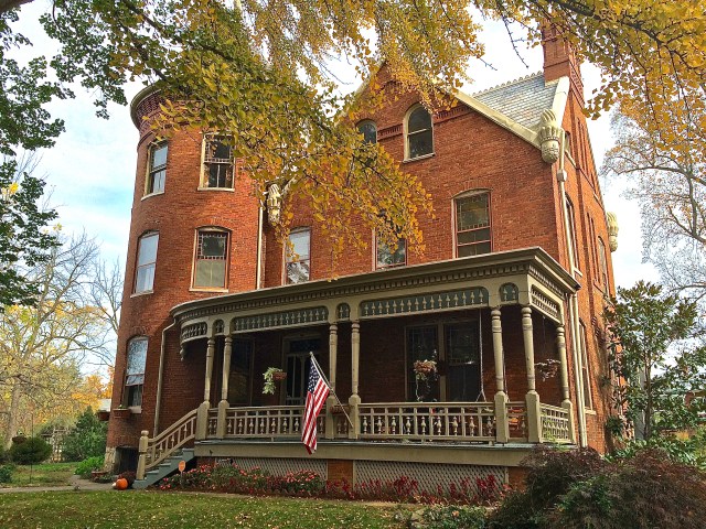
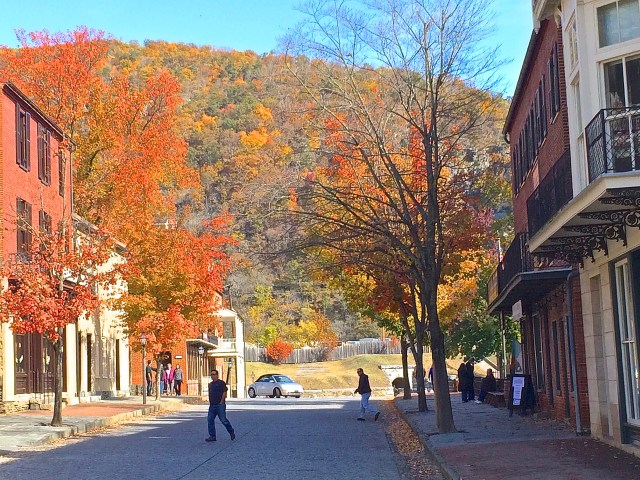
Charles Town (my residence for the 3 months I was in the area) offers a large variety of historical reflections on both the Colonial/Revolutionary period and the era of the Civil War.
Jefferson County Courthouse where John Brown was tried and convicted of Treason
John Brown was jailed, tried and executed here in 1859. His story, more than any other, illuminates the unrestrained passions of the time. Anger based on a deep-seated fear vs. an uncompromising righteous indignation would lead to the destructive calamity of Civil War. I understand more about the passions that drove us to war now that I have taken the time to visit Charles Town and hear John Browns story in the place where it ended for him and at the same time set in motion events that could no longer be controlled, resulting in the loss of 620,000 American lives – more than, W.W. I — W.W. II — Vietnam and Korea combined.
The town was incorporated and named by Charles Washington (George Washington’ younger brother) on land that was surveyed by George in his teens and inherited from Lawrence Washington (George’s older brother). The main street running East and West was named Washington St. with the major intersecting North and South streets named after members of the family (George, Lawrence, Charles etc.). As such, the town is a thriving monument to the Washington Family.
“HAPPY RETREAT” – Home of Charles and Mildred Washington where George was a frequent guest. Charles and Mildred are buried on the estate.
When you visit Charles Town I recommend that you stop by the Visitors Center (Close to the corner of George and Washington Streets) and pick up a copy of the Walking Guide to Georgetown that maps the location of over 30 homes (giving brief histories of each) that are within walking distance. The homes were built from the mid-1700s to the early 1900s and all are proudly maintained on well-shaded streets that seem to be made for easy strolling on a sunny afternoon.
The side-yard of this Gibson-Todd House is the site of John Brown’s execution
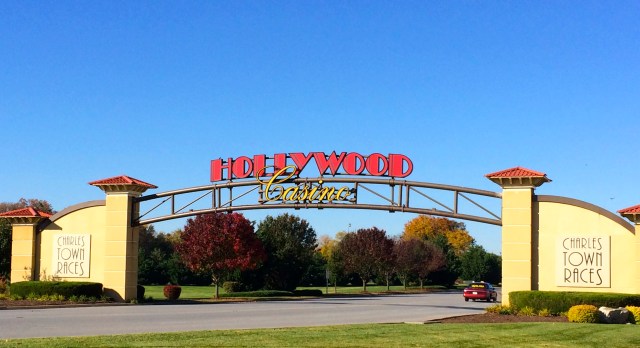
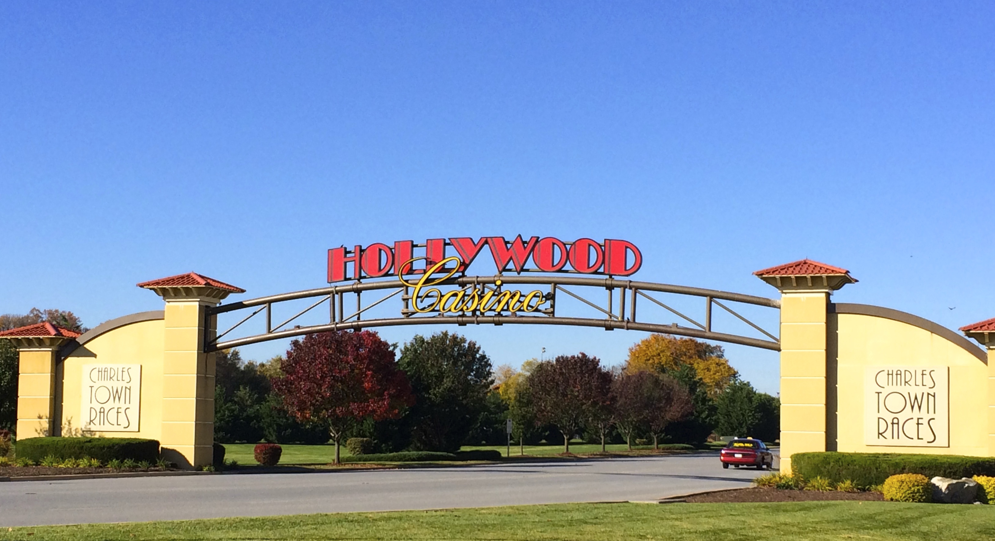
When I had enough of touring neighborhoods it was time to visit the local “fun spot.” Over 80 years ago the Jefferson County Race Track was established in Charles Town and successfully drew fans from the greater metropolitan area which includes Baltimore and Washington DC. In 1997 Penn National bought the track and began a $175,000,000 Charles Town Race Track renovation and construction of the Hollywood Casino. Much renovation and add-on construction has taken place since then, making the Charles Town Races and Hollywood Casino one of the premier gaming venues on the East Coast. I enjoyed my time in Jefferson County. People watching at the Hollywood Casino and cheering for the Thoroughbreds as they blurred by at the Charles Town Races were two of my favorite memories.
Entrance to Casino and Race Track
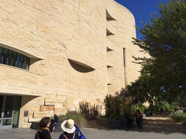
One of the reasons that I decided to spend 12 weeks in the Charles Town WV area was that it is relatively close to Washington DC and I wanted to revisit and explore our nations capital. Top of my priority list was to see the National American Indian Museum, which turned out to be the only disappointment in my 3-month stay.
In retrospect, I suppose that my expectations were too high. I expected to discover some of the cultural similarities and differences between the myriad of separate and unique tribes that compose what we call “American Indians.” I expected a peek at how they conducted their lives on a daily basis with examples of how they demonstrated their values in what they did. I hoped for a deeper understanding of their Spiritual life and how that influenced their rituals as well as their daily lives.
What I observed was extremely well organized displays that seem to be designed in unison by someone with an excellent understanding of color, texture and eye-appealing presentation — very pretty — very politically correct and sterile.
The high point of the museum visit was the building. It is architecturally grand, inside and out. To experience the building is worth the effort to visit the museum.
What I assumed would be 4 or 5 trips to Washington turned out to be only 1 trip. The attractions of Jefferson County WV. kept me securely on a tether that extended in a 30-mile radius of Charles Town.
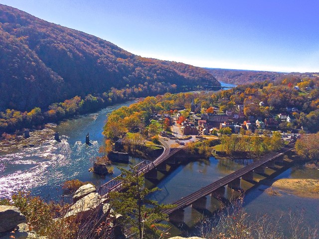
Harpers Ferry on a Fall morning
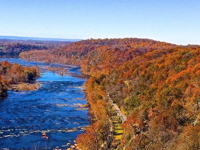
Harpers Ferry, just 5 miles from Charles Town, kept calling me back for yet another visit. Having returned 4 times during my 3-month stay, I think it is safe to say that I was somewhat infatuated with the place. The geographic location of the town adjacent to intertwining rivers as they turn and rush through the iconic Blue Ridge Mountains, plus the historic role that Harpers Ferry played both before and during our Civil War are just 2 of the reasons for my fondness of the place. I should also mention:
The scenic vistas from historic battlefields and from Maryland Heights.
The dazzling confluence of the Potomac and Shenandoah rivers as they pass through the Blue Ridge Mountains,
The entertaining and informative tours given by the National Park Rangers covering John Brown’s raid on the armory in 1859 and his subsequent trail and execution.
Biking along the Potomac River on the historic C&O towpath and hiking – especially to the overlook on Maryland Heights.
Wandering through a town that was hand picked by George Washington to house the 1st US armory and due to the spectacular location at the confluence of the Potomac and Shenandoah rivers was a major manufacturing site and a major transportation crossroads at pivotal times during our history.
From Left to Right – The Blue Ridge Mountains in Virginia, The Shenandoah River, The town of Harpers Ferry WV., The Potomac River. Photo taken from the overlook on Maryland Heights.
I left West Virginia on the November 22 and headed for the Minneapolis Area then to St Louis, MO – Dallas, Texas – La Veta, CO – Phoenix, AZ and arriving in Santa Fe, NM. for New Years Eve and a 3-month stay. The plan is that you will hear from me on this web-site, at least, every week. Have a great holiday.
It was the first week in November and I was determined to keep a promise I made to myself. Earlier, during the last week of September I made the trek to the Maryland Heights Overlook and took photos that included the view from above the confluence of the Shenandoah and Potomac rivers, the surrounding mountains and the town of Harpers Ferry. I knew then that I had to make the trek again when the leaves were turning. I was a week late, from a peak color point of view, but I had to give it a try.
The morning Sun in the Fall at Harpers Ferry WV.
Photo taken during the last week in September of the confluence of Shenandoah on right and Potomac on the left as they run through the gap.
The geographical location of Harpers Ferry, combined with the abundance of natural resources shaped it’s history. The confluence of the Shenandoah and Potomac and the forming of the gap in the Blue Ridge Mountains provided a way to travel from east to west and also created a space of spectacular beauty. Upon his arrival to this area in 1747, Robert Harper was inspired to write: “O Thou great Being above, whose hands but Thine could have created so much sublimity and grandeur.”
Not a cloud in the sky – no wind and about 60 degrees – a great way to start a hike. The trail map says its about 2.75 miles from Harpers Ferry, across the Potomac, follow the old tow path along the Potomac River then up the mountain to the Maryland Heights Overlook.
View from the bridge as the Shenandoah enters from the right.
The way is flat and easy strolling till you get to the mountain trail. The trail (blazed by Union troops during the Civil War who made it wide enough to get cannon up the mountain in a effort to hold the river) will easily accommodate hiking two abreast up the mountain. However, it is a little steep. I’m a slow, stop and “admire the view,” hiker and I noticed that as the trail continued my view admiring became more frequent.
View from the bridge back toward Harpers Ferry with the steeple of the Catholic Church in the background
As I began the hike by walking the bridge that spans the Potomac I was struck with the feeling that there was something magical about the confluence of the Shenandoah and the Potomac. Maybe it just seems that way because you can get such an up-close view of two clear water rivers coming together in such a joyful way. It is as if they were two young girls running together, joining hands and racing through the gap in the mountains. There is no shortage of places and perspectives to observe this mesmerizing event. One of my favorites is from the bridge.
Once across the bridge you head north on a well-maintained old towpath that occupies the space between the Potomac River and what was the old Chesapeake and Ohio Canal. This towpath hugs the Potomac and C & O Canal for 184 miles (from Washington DC to Cumberland Maryland.) As you walk north giant Sycamores, growing in single file along the bank of the Potomac, provide shade. Kayakers and rafters negotiate the rocks and rapids as the river pushes by you toward Washington.
Potomac River on the left in late Summer as you hike north on the C&O Towpath past the Sycamores
The Blue Ridge Mountains form a beautiful natural barrier off to the right, just beyond the dry canal bottom that was the C&O Canal and a narrow winding road that twists and turns like the contour lines on a map. One hundred and eighty-four miles of level maintained trail, with the rambunctious Potomac on one side and the Blue Ridge Mountains on the other, makes for great hiking/biking.
This is the view from the Maryland Heights Overlook to the north. You can see the Potomac on the left, then the Sycamore trees, then the towpath, old canal, road and part of the trail going up the Blue Ridge Mountains.
A few hundred yards down the towpath you turn right, cross the old canal on a narrow hiking bridge, then across the road where the mountain portion of the hike begins. The trail leads up the mountain through a hardwood forest and stays fairly steep except for a few short flat sections that keep your spirits up.
One of the few flat spots on the way up the mountain.
It took me 1 hour and 45 min to hike to the overlook starting from the parking lot at the train station in Harpers Ferry and 1 hour and 5 min to hike back down. During the 2 and a half months that I have been exploring the area, I have been to Harpers Ferry 4 times and twice hiked up the mountain. I love it. If you are ever in the neighborhood, come take a look.
The Shenandoah on the left – the Potomac on the right with the town of Harpers Ferry in the middle. Photo taken the first week in November from the Maryland Heights overlook — My guess is that this is about a week after the “peak”
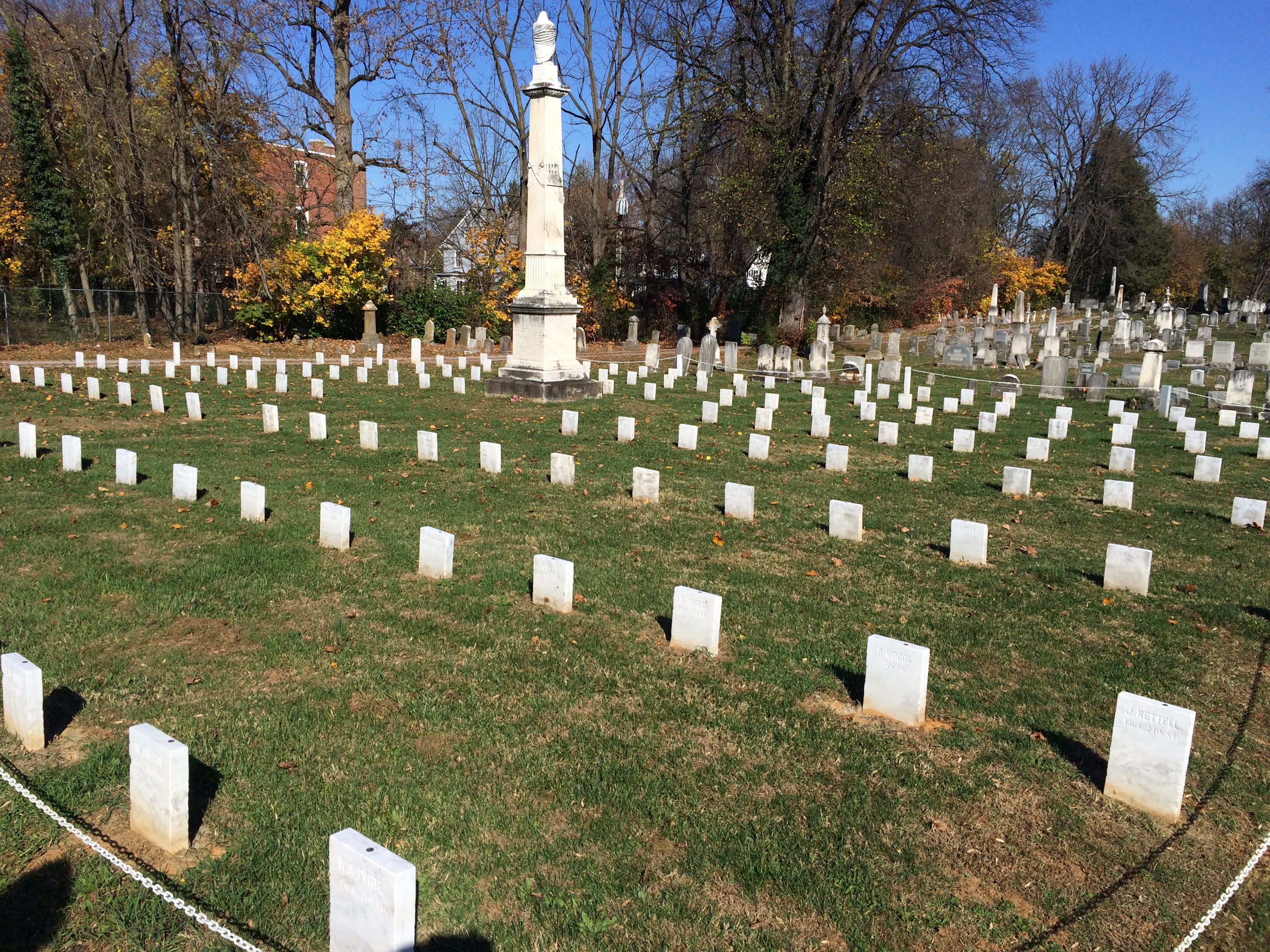
I have always liked cemeteries, both on the thought or imagination level and on the feeling or spiritual level. There is never any fearfulness or discomfort or even sadness for me to contend with. Even when visiting the graves of my parents the quietness, peacefulness and natural beauty of the place leaves little room for the negative.
About 70 Confederate graves in the front section of Edge Hill Cemetery in Charles Town WV. The soldiers died from wounds suffered on September 17, 1862 at Battle of Antietam.
The thoughtful or imagination sides of my cemetery strolls bring great entertainment. To find the graves of a 90-year-old man buried next to the three wives he outlived are fertile facts for my active imagination. I can only imagine why so many children died in a given year. Was it a disease and if so, what that must have been like for the community?
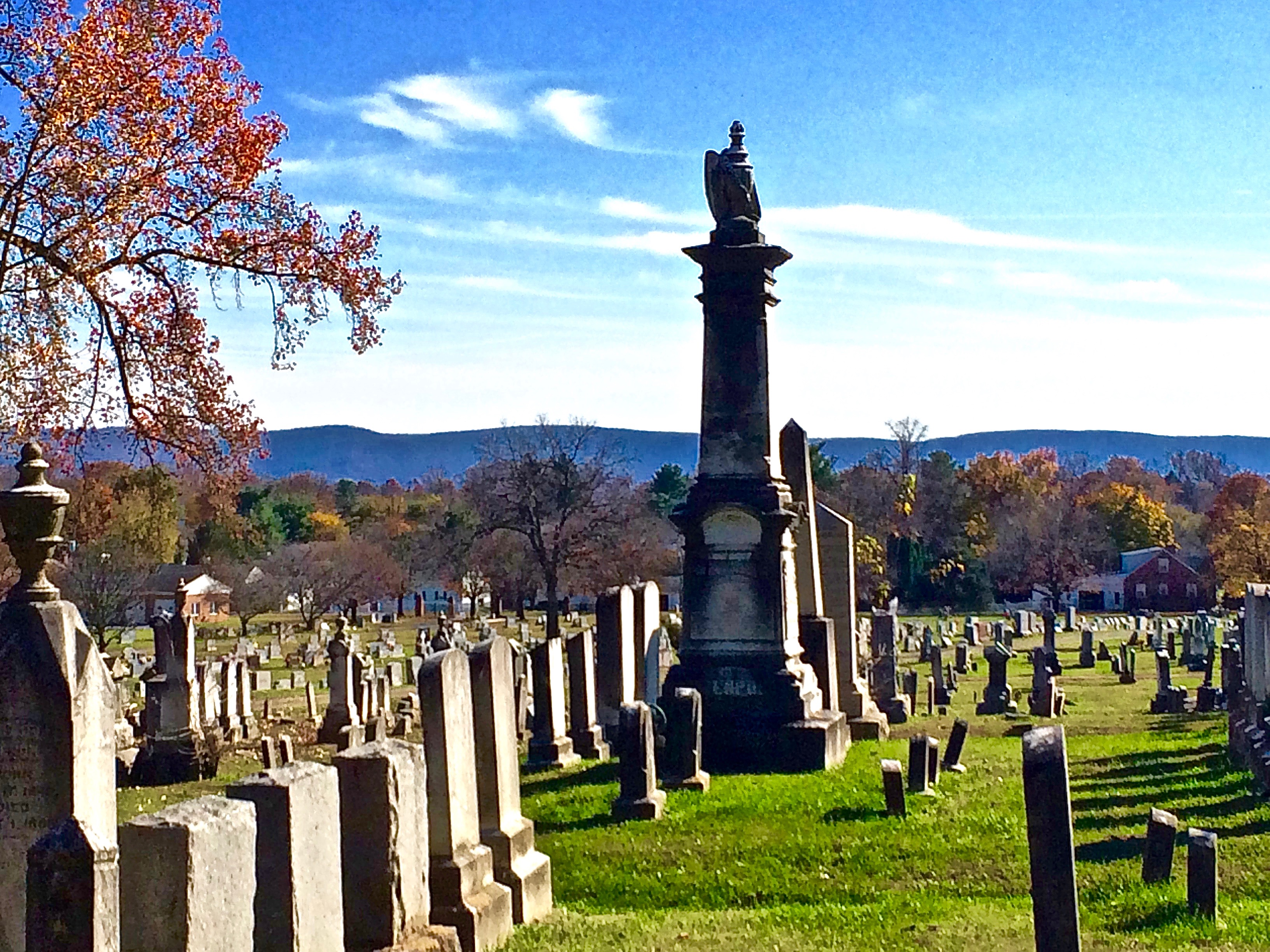
I do enjoy the imagination game of reading tombstones but, in truth, the major attraction that makes cemetery strolling so compelling to me is the non-thinking, feeling, spiritual side of the experience. The compelling spirituality of the place means that I find it difficult to have a conversation in a cemetery. I tend to wander off and cover myself in solitude and be at peace with ever-present death.
Wandering through the Edge Hill Cemetery in the late fall with the Blue Ridge Mountains off to the East.
The absence of human life – the sense of the presence of the “end of the struggle” with all of its past clamorous joys and sorrows – the finality of the peace that surrounds, allows me to open to the beauty and serenity of the moment. My steps become lighter – slower with a purpose that is beyond movement.
I leave you with a thought on Cemetery Strolling.
“To think is to participate in life. To feel is to experience life. Cemeteries are fertile ground for both.”
It is Saturday night and time for me to explore the Charles Town Race Track and Hollywood Casino. I must tell you, up front, that I am not much of a casino gambler. The thought of putting money into a machine, pulling the handle to watch drawings of fruit spin and then … doing it all over again, does not appeal to me. Gambling in casinos does not “float my boat” however, the atmosphere does. The sight and sound of acres of slot machines being played, the excited cheering and high-fiveing going on at the crap table, the intimate excitement shared by a small group around a Blackjack dealer. In short, “I love people watching in casinos.”
The Hollywood Casino certainly has every thing you would expect: Live shows featuring top named entertainment, 3500 slot machines, blackjack, craps, roulette, huge poker room, Mini-Baccarat, Pai Gow Poker, 3 excellent restaurants and a crowd of people that seem to be having a great time in a lights flashing, bell ringing atmosphere.
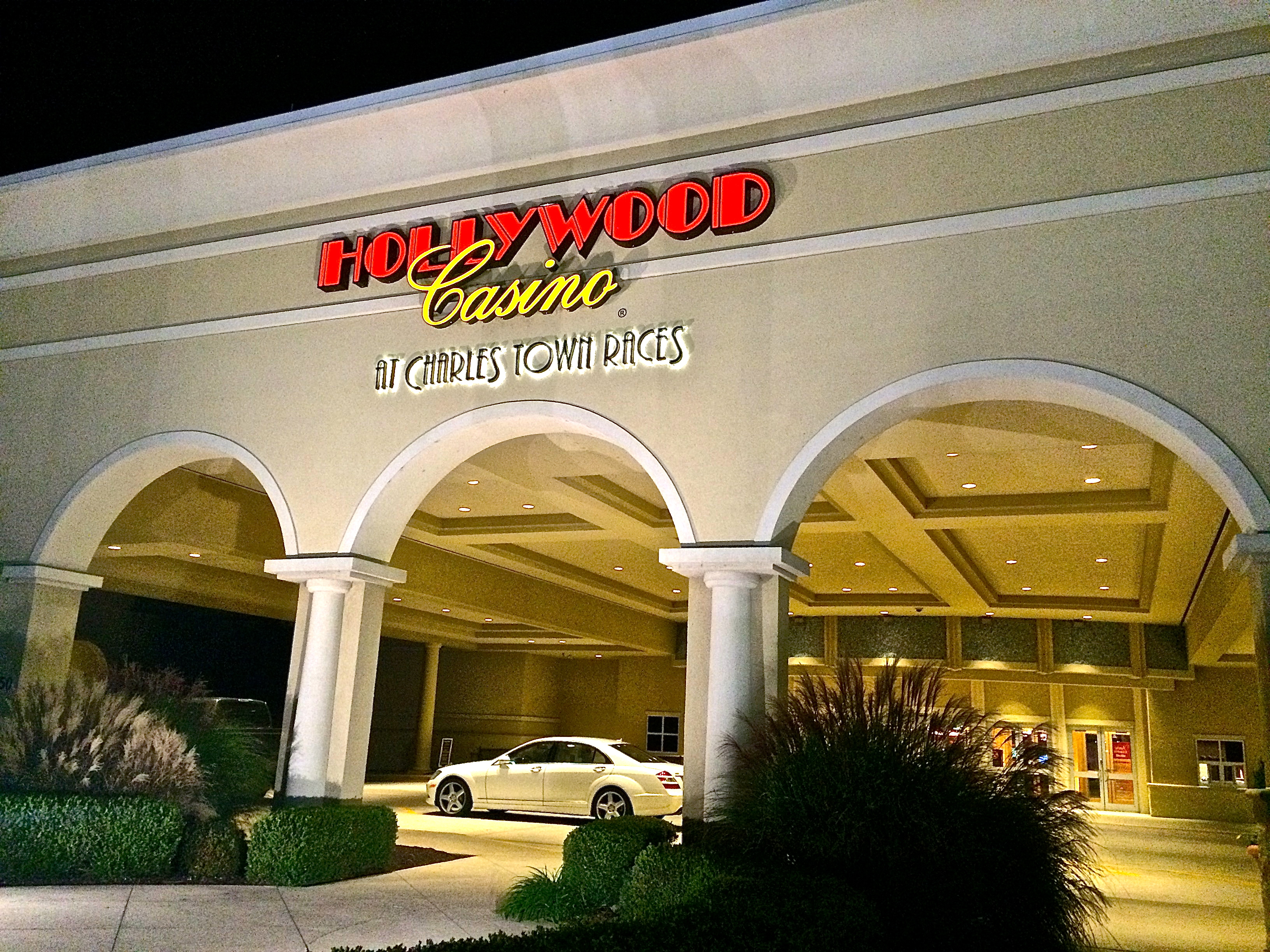
Since photos are not allowed inside the casino, this entrance photo will have to do
Having completed my binge of people watching and satisfied my hunger at 9 Dragons Restaurant (Oriental food – specializing in Hong Kong cuisine – one of the best I have experienced) I walk thru the casino to the adjacent Charles Town Race Track.
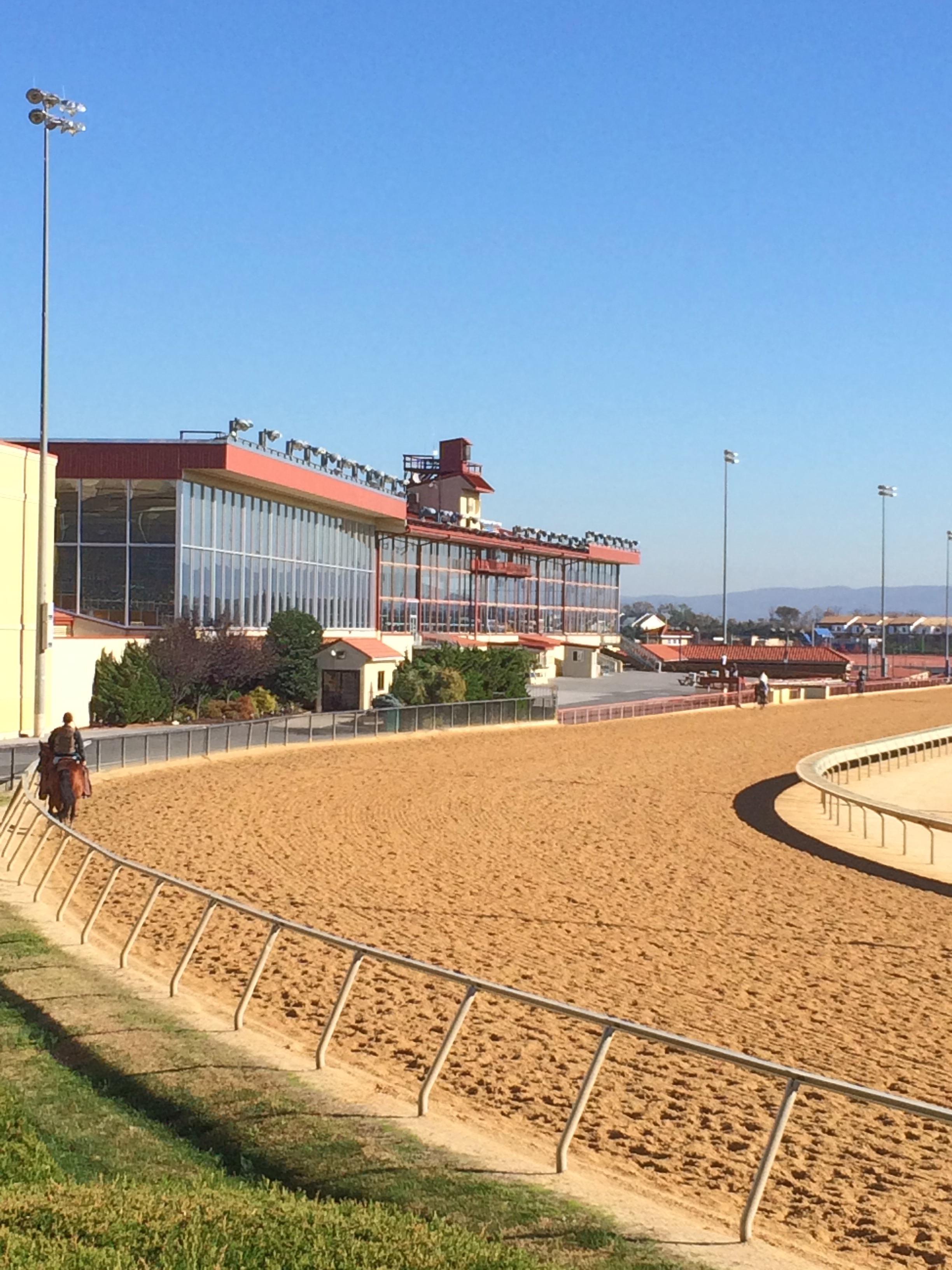
Over 80 years ago the Jefferson County Race Track was established in Charles Town and successfully drew fans from the greater metropolitan area which includes Baltimore and Washington DC. In 1997 Penn National bought the track and began a $175,000,000 Charles Town Race Track renovation and construction of the Hollywood Casino. Much renovation and add-on construction has taken place since then, making the Charles Town Race Track and Hollywood Casino one of the premier gaming venues on the East Coast.
The Charles Town Races began in 1933 and continues to provide one of the top gaming venues in the Northeast.
By now you probably realize that I am not much of a gambler however, upon occasion, I will place a small bet at a horse race. I average attending horse races once every 10 years or so and I rarely stay for all the races. I also have a very strict method of handicapping (guide for choosing which horse or horses to bet on) that I will share with you.
Always bet on the grey horse. (Usually $2 to Show)
If the horse has a name that is funny, nostalgic, uniquely appropriate or in some way “tickles my fancy,” bet on it. (Usually $2 to Show)
If the horse takes a crap in the paddock before the race, bet on it. (Mandatory $2 to Win)
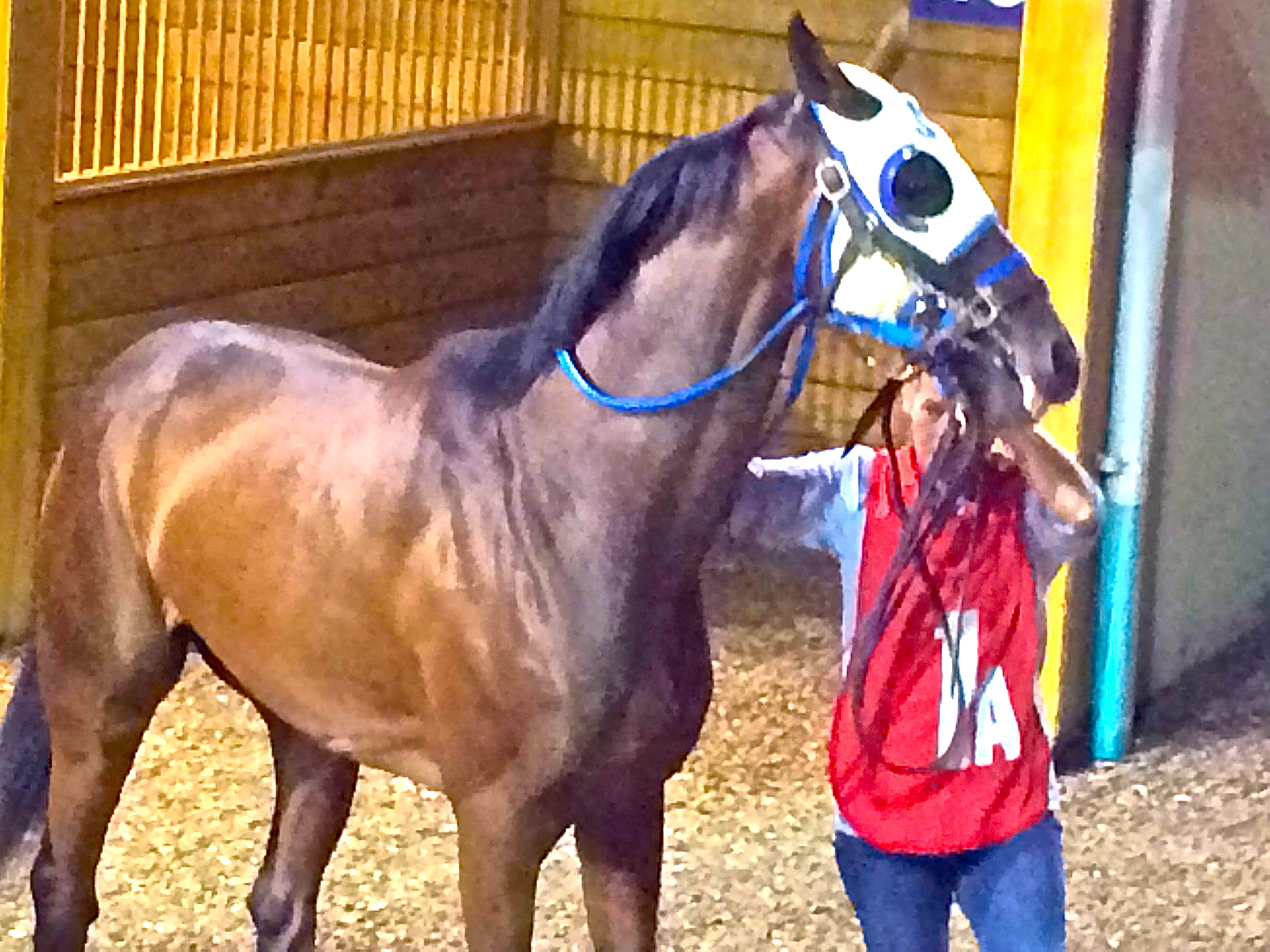
This method has proven to be, for the most part, financially unsuccessful but it is a lot of fun. As an example, on the night in question, I arrived at the track just after the 2ed race, got a beer and sat down on the benches outside close to the rail and commenced to “people watch” while enjoying 3 races and 2 more beers. About 15 minutes before post time I noticed on the tote board that there was a horse named “Sergeant Schultz” running in the 6th race.
The equine version of Sargent Schultz
Maybe some of you are old enough to remember the late 60’s sitcom “Hogan’s Heroes.” The comedic action took place in a German POW camp during WWII. One of the characters was “Sergeant Schultz” whose favorite line was, “I KNOW NUT-ING.”
A horse called Sergeant Schultz!! That was it for me so I decided to head for the paddock and have a look. Well, as it turned out, Sargent Schultz was a great looking horse and … there was also a grey horse (whose name I can not remember) in the same race. I waited patiently and watched very closely but there was no “pooping” going on. With little time to spare I rushed to the betting window and put $2 on Sergeant Schultz to Show and $2 on the grey horse to Show. I managed to squeeze into a spot on the rail at the finish line as the race began. From the beginning it was looking good. Both my horses were in contention. At the final turn Sergeant Schultz was in 1st and the grey horse was in 2nd. I was yelling and screaming and really into it as, over the final 50 yards of the race, Sergeant Schultz slipped into 2ed and the grey horse fell to 4th.
As it turned out, Sergeant Schultz was the favorite and paid $2.20 on my Show ticket and my fourth running grey horse paid “NUT-ING.” With a smile on my face I called it a night and headed to the car. I had bet $4.00 and won $2.20 leaving a net loss of $1.80. It was a great time and I leave you with this thought on horse racing.
“When you are a $2 “bettor” you can afford to have a good time no matter what happens.”